
City of Griswold, Iowa

Zoning Map.pdf

Reading copy. The PDF remains the city's file.

This is a reading copy of the city's PDF. The wording below is the text from that file. The map image is the official drawing. The text is the title, legend, and certification printed on it.

Download the PDFBack to Planning and zoning

City of Griswold, Iowa

Official Zoning Map
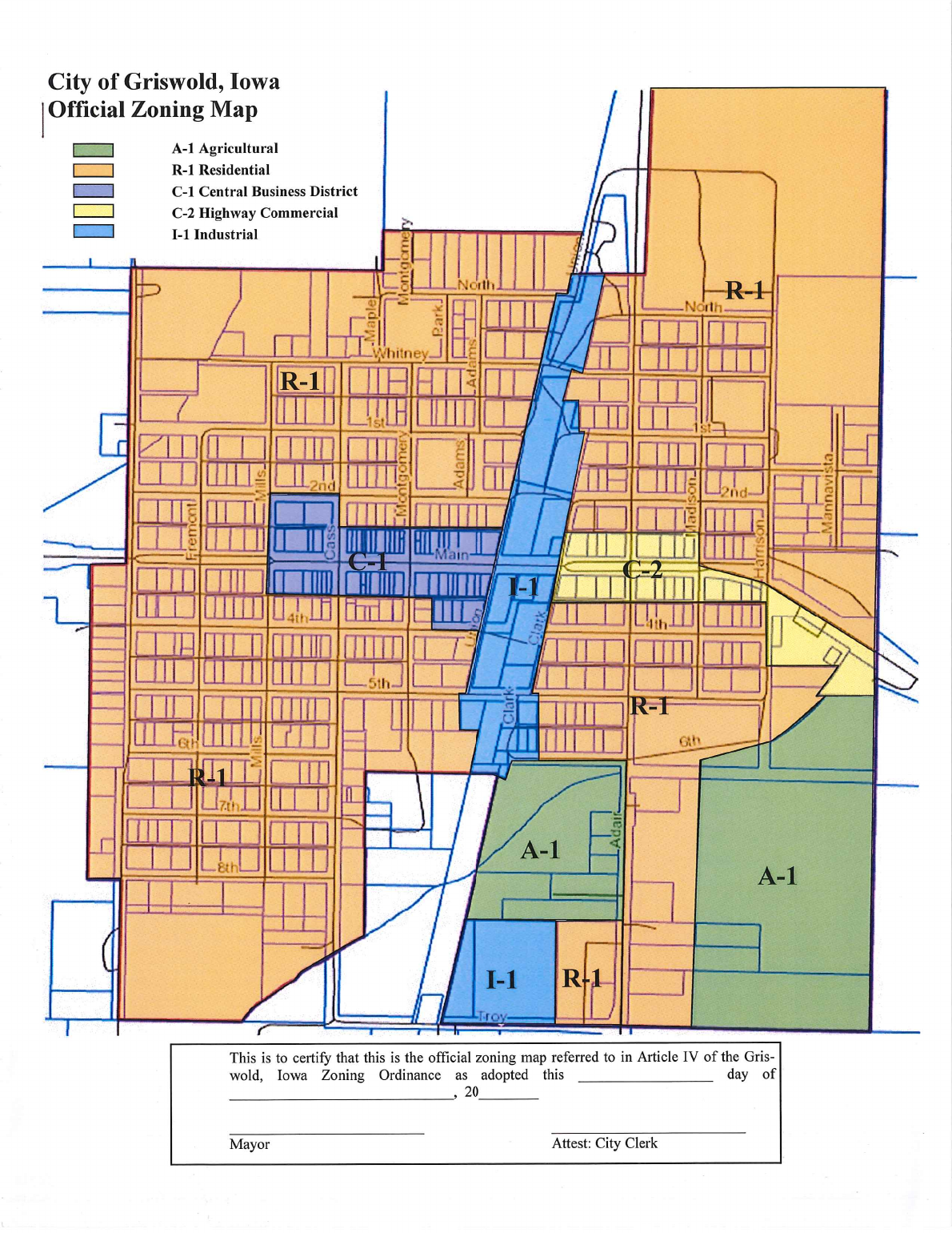
City of Griswold, Iowa, Official Zoning Map. The legend shows A-1 Agricultural in green, R-1 Residential in orange, C-1 Central Business District in purple, C-2 Highway Commercial in yellow, and I-1 Industrial in blue. Those colors are drawn over the town street grid, with district labels printed on the map. A certification box and blank signature lines for the Mayor and the City Clerk are at the bottom. Some small street labels are too fine to repeat here; they are on the map image and in the PDF.
This is to certify that this is the official zoning map referred to in Article IV of the Griswold, Iowa Zoning Ordinance as adopted this ______ day of ______________, 20____.

Legend

  • A-1 Agricultural
  • R-1 Residential
  • C-1 Central Business District
  • C-2 Highway Commercial
  • I-1 Industrial

This is to certify that this is the official zoning map referred to in Article IV of the Griswold, Iowa Zoning Ordinance as adopted this ______ day of ______________, 20____.

Mayor

Attest: City Clerk